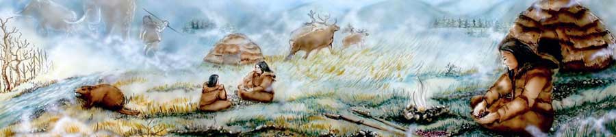
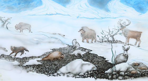
An Ice-Age World
Present-day Mi’kma’ki was formed largely through the actions of glaciers that have advanced and retreated over large parts of North America for hundreds of thousands of years. Most recently, the glaciers melted away and retreated northward between 13,000 and 9,000 years ago. The movement and melting of the glaciers changed sea levels, temperature, precipitation, and greatly influenced the animals and plants that could survive in Mi’kma’ki.
What Did the Ice-Age Look Like?
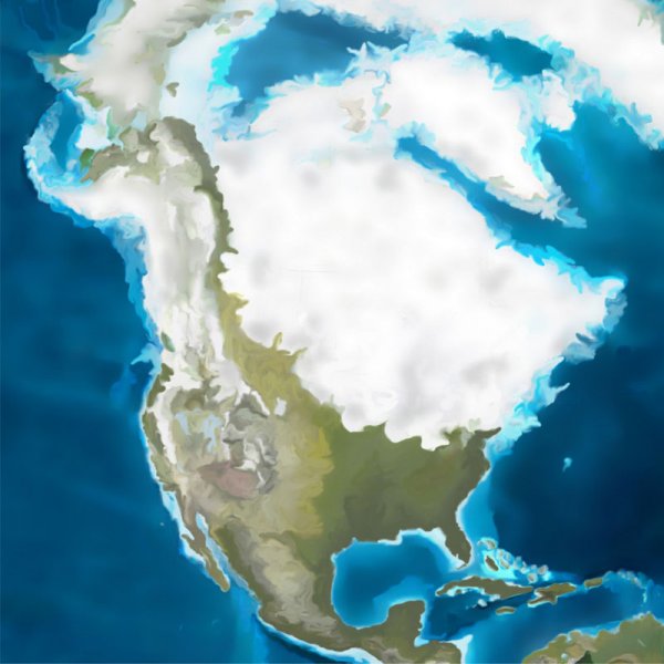
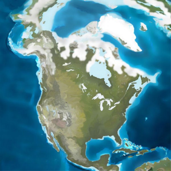
North America has been through repeated major continental glaciations over the last 2.6 million years. Each time, large glaciers advance over vast areas of the continent for thousands of years and then retreat again as shown in this schematic.
The period between 13,000 and 9,000 years ago was a time of extreme climate change. After the glaciers reached their greatest extent (about 21,000 years ago), they slowly melted and retreated over thousands of years. By 13,000 years ago, Mi’kma’ki was quite warm (almost as warm as today), but then, very suddenly, the area was plunged into a mini-ice-age, whichscientists call the Younger Dryas and lasted for about 1,000 years. Curiously, the dates for this mini-ice age correspond very closely to the dates at the Debert sites. After this time, Mi’kma’ki becomes increasingly warmer.
The process of deglaciation is not just about the ice melting, or retreating. When the ice retreats, it is so heavy that the land actually bounces back—a process called isostatic rebound. In addition, as glaciers melt, they add water to the oceans raising sea levels across the globe. This complex interplay of ice retreat and land and sea levels rising exposes land masses such as Georges Bank at certain times and then covers them with water at other times. It is almost as if the land and sea levels are competing with each other—whether we have new land areas emerging or increasing sea levels is just a question of which one is rising faster at any given time.
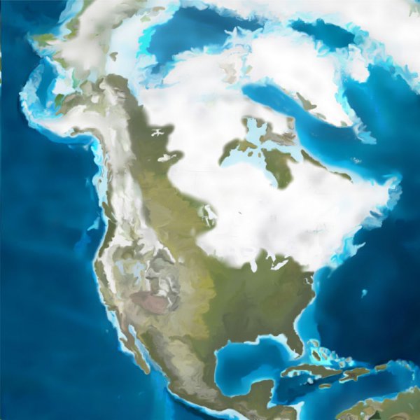
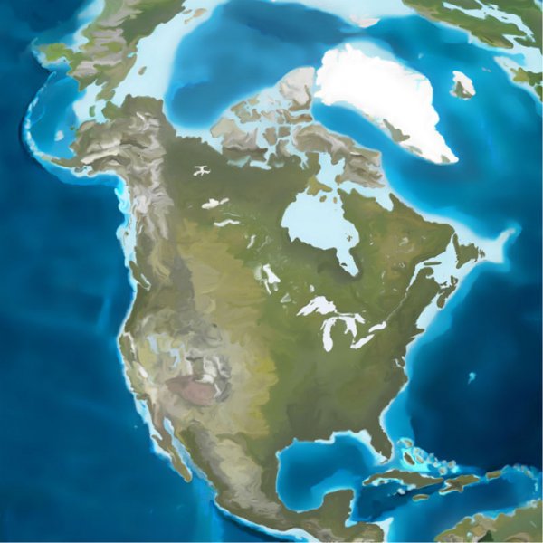
Regional Deglaciation


Minas Basin Deglaciation


These two slideshows show deglaciation from a regional perspective (left) and a closer view of the Minas Basin area where the Debert site is (right). The images on the left are courtesy of Dr. John Shaw, Bedford Institute of Oceanography. The images on the right are courtesy of Dr. Ralph Stea, Emeritus Scientist, Nova Scotia Department of Natural Resources.


 sharing our stories
[…] https://www.mikmaweydebert.ca/home/ancestors-live-here/debert/an-ice-age-world/ […]
This is such important information. Thank you for posting it! It is accessible and easy to understand. Together the captions, photos & maps tell the (freezing cold!) story together.
PS One of the depictions of the Minas Basin has been flipped (it’s backwards). It may be especially confusing for people who aren’t familiar with map images of Mi’kma’ki (or more specifically, Minas Basin & Cobequid Bay).